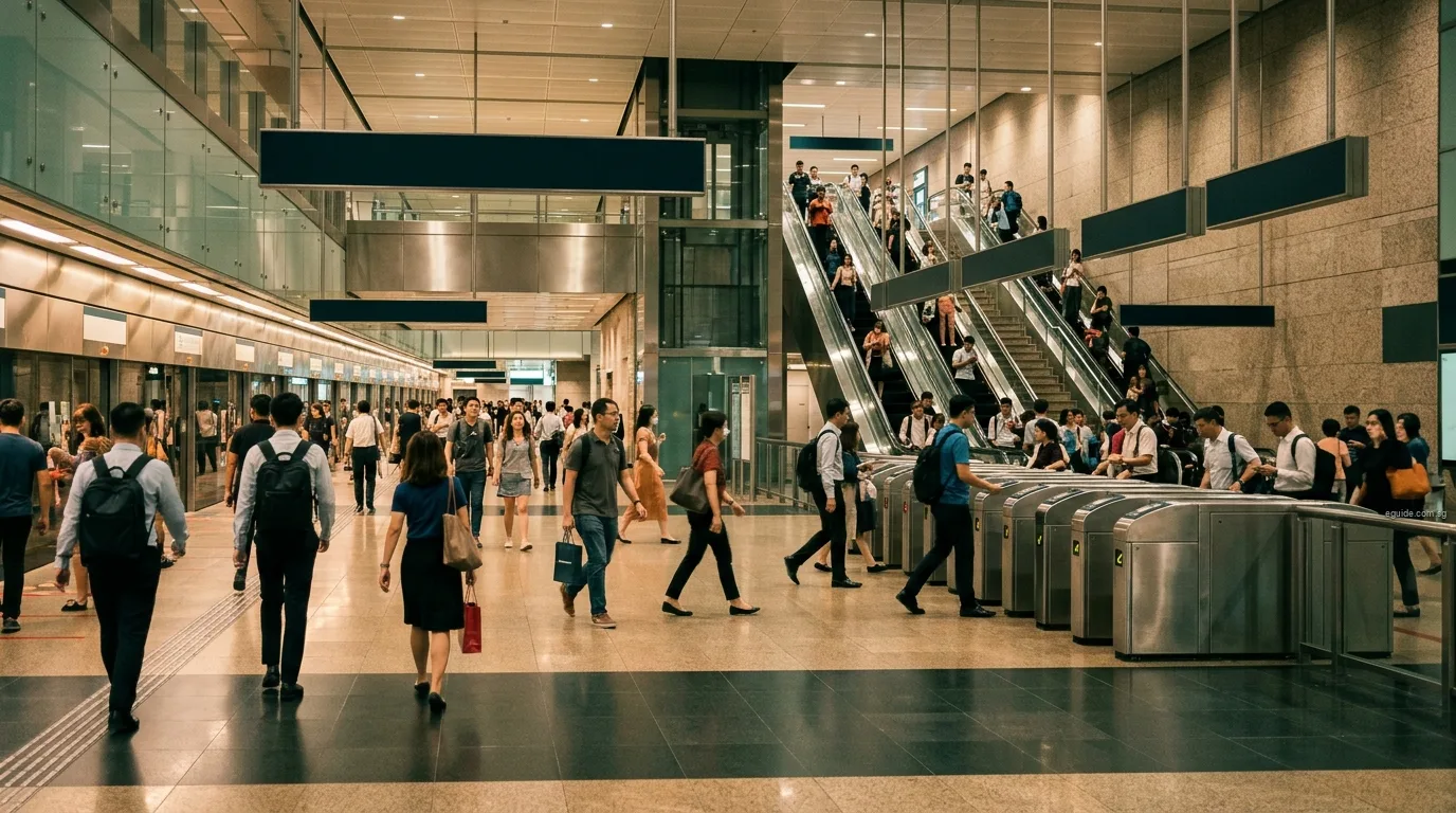
Singapore's rail network is the backbone of daily travel for most people who live here. It has two parts. The MRT, or Mass Rapid Transit, is the main network of six lines that carry passengers between towns and into the city. The LRT, or Light Rail Transit, is three smaller systems that carry residents from the estates of Bukit Panjang, Sengkang and Punggol to the MRT. LTA, the Land Transport Authority, plans and builds the network, and two companies, SMRT and SBS Transit, run the trains.
This guide explains how the pieces fit together: the lines and their colours and codes, the stations where you change, who operates what, the fares in force today and the change announced for 26 December 2026, the concession schemes, how stations are made accessible, and the new lines LTA has announced with its target dates. Each line has its own page with every station in order, and every station is linked to the eGuide area page for the planning area it serves.
The network at a glance
LTA describes the MRT as more than 140 stations on six lines and the LRT as more than 40 stations. Its table of rail network length gives 242.5 km of MRT and 28.8 km of LRT at the end of 2024, a figure that has grown since with the Circle Line's final stage in July 2026.
The lines follow a simple logic. Four lines run outwards from the city centre into the suburbs: the North-South Line to the north and west, the East-West Line to the east and west, the North East Line to the north-east, and the Downtown Line to the north-west and east. The Thomson-East Coast Line runs from the far north through the centre and out along the East Coast. The Circle Line rings the city, crossing all the others so that riders can travel between suburbs without passing through the centre. The LRT systems sit at the ends of the lines, feeding three towns into the MRT.
| Line | Codes start | Map colour | Operator | Stations open | Stations announced |
|---|---|---|---|---|---|
| North-South Line | NS1 | red | SMRT | 27 | 2 |
| East-West Line | EW1 | green | SMRT | 35 | 0 |
| North East Line | NE1 | purple | SBS Transit | 17 | 0 |
| Circle Line | CC1 | orange | SMRT | 33 | 0 |
| Downtown Line | DT1 | blue | SBS Transit | 35 | 4 |
| Thomson-East Coast Line | TE1 | brown | SMRT | 27 | 5 |
| LRT lines | BP1 STC PTC | grey | SMRT and SBS Transit | 42 | 0 |
| Cross Island Line | CR2 | – | – | 0 | 25 |
| Jurong Region Line | JS1 | – | – | 0 | 25 |
The colour of a line is the colour it is drawn in on LTA's system map and on station signs. The letters at the start of each station code tell you the line: a station called NS16 is the sixteenth station on the North-South Line. The Cross Island and Jurong Region lines have no stations in service yet, so they appear in the table with the stations LTA has announced.
The lines, one by one
North-South Line (red, NS). The first MRT line, opened in 1987. It runs about 45 km from Jurong East in the west, around the north of the island through Woodlands and Yishun, and south through Ang Mo Kio, Bishan and Orchard to Marina South Pier. It has 27 stations, and two more are planned, at Brickland and Sungei Kadut.
East-West Line (green, EW and CG). The longest line, at about 57 km, with 35 stations. It crosses the island from Pasir Ris in the east to Tuas Link in the far west, through Tampines, Bedok, Geylang, the city, Queenstown, Clementi and Jurong. A two-station branch from Tanah Merah serves Expo and Changi Airport.
North East Line (purple, NE). Opened in 2003, about 22 km, with 17 stations, all underground. It runs from HarbourFront through Chinatown, Dhoby Ghaut and Serangoon to Hougang, Sengkang and Punggol, ending at Punggol Coast. LTA notes that it was the world's first fully automated underground driverless heavy rail line.
Circle Line (orange, CC). A ring of about 39 km and 33 stations around the city, opened in stages from 2009 and completed as a full loop on 12 July 2026. It meets every other MRT line.
Downtown Line (blue, DT). About 42 km and 35 stations, all underground, from Bukit Panjang through Bukit Timah and the city to Tampines and Expo. Two more stations, Xilin and Sungei Bedok, open on 26 December 2026.
Thomson-East Coast Line (brown, TE). The newest line, opened in stages from 2020. It runs from Woodlands North through Thomson, Orchard and Marina Bay and along the East Coast to Bayshore, with Bedok South and Sungei Bedok opening on 26 December 2026.
LRT lines (grey, BP, SE, SW, PE, PW). The Bukit Panjang LRT (1999), the Sengkang LRT (2003) and the Punggol LRT (2005), each a feeder to the MRT.
Cross Island Line (CR and CP) and Jurong Region Line (JS, JE and JW). The next two lines, with first stages targeted for 2030 and 2028.
How the network grew
The MRT opened in 1987 and has grown in steps ever since. LTA's table of rail network length records when each line and extension opened:
| Year | What opened |
|---|---|
| 1987 | First MRT stretch, Yio Chu Kang to Toa Payoh, then on to the city |
| 1990 | Original East-West Line completed to Boon Lay |
| 1996 | Woodlands Extension of the North-South Line |
| 1999 | Bukit Panjang LRT |
| 2002 | Changi Airport branch |
| 2003 | North East Line and Sengkang LRT |
| 2005 | Punggol LRT |
| 2009 | Boon Lay Extension; Circle Line Stage 3 |
| 2010 to 2012 | Rest of the Circle Line to HarbourFront, then Bayfront and Marina Bay |
| 2013 to 2017 | Downtown Line, in three stages |
| 2014 | North-South Line extension to Marina South Pier |
| 2017 | Tuas West Extension |
| 2020 to 2024 | Thomson-East Coast Line, Stages 1 to 4 |
| 2024 | Punggol Coast, on the North East Line |
| 2026 | Circle Line Stage 6 in July; TEL5 and the Downtown Line extension in December |
The pattern is clear from the table. The first lines linked the biggest towns to the city; later lines filled in the gaps between them, and the newest ones reach places the first network missed, such as Marine Parade, Bukit Timah and the far north-east.
How station codes work
Every station has a code made of the line's letters and a number. The numbers run in order along the line, so you can tell which way a train is heading by whether the numbers are rising or falling. Some numbers are missing: there is no NS6, NE2 or CC18 in service, and the Thomson-East Coast Line skips TE10 and TE21. Several of these gaps belong to stations that are planned or built: NS6 is Sungei Kadut, due in 2035, and TE10 and TE21 are Mount Pleasant and Marina South, which open with the developments around them. When a new station opens between two existing ones and no code is free, it takes a letter suffix: Brickland, planned between Bukit Gombak (NS3) and Choa Chu Kang (NS4), will be NS3A.
An interchange carries one code for each line it serves. Dhoby Ghaut, for instance, is NS24, NE6 and CC1. On platform signs and maps the codes appear in coloured tags, which is also how our area guides show them.
Some stations carry a branch code. The two stations on the East-West Line's airport branch use CG, and the LRT loops use codes that combine the town and the direction: SE and SW for Sengkang's east and west loops, PE and PW for Punggol's. The LRT hub stations, where riders change to the North East Line, are coded STC and PTC.
Where the lines meet
Interchanges are where the network becomes a network. Three stations today serve three lines each:
- Dhoby Ghaut: North-South, North East and Circle lines. It opened in December 1987 and became the first station shared by three lines.
- Outram Park: East-West, North East and Thomson-East Coast lines.
- Marina Bay: North-South, Circle and Thomson-East Coast lines.
Many more serve two lines. In the city, City Hall and Raffles Place link the North-South and East-West lines; Bugis, Chinatown, Little India, Newton, Promenade and Bayfront connect the Downtown Line with older lines; and Orchard and Stevens bring in the Thomson-East Coast Line. Outside the centre, the main changes are at Jurong East (North-South and East-West), Woodlands (North-South and Thomson-East Coast), Bishan (North-South and Circle), Serangoon (North East and Circle), Paya Lebar (East-West and Circle), Tampines (East-West and Downtown), Buona Vista (East-West and Circle), Botanic Gardens and Macpherson (Circle and Downtown), Caldecott (Circle and Thomson-East Coast), HarbourFront (North East and Circle) and Expo (airport branch and Downtown).
The LRT systems connect at Choa Chu Kang and Bukit Panjang for the Bukit Panjang LRT, at Sengkang for the Sengkang LRT and at Punggol for the Punggol LRT.
From 26 December 2026, Sungei Bedok becomes a new interchange between the Thomson-East Coast and Downtown lines. The Cross Island Line will add links at Pasir Ris, Hougang, Ang Mo Kio, Bright Hill, King Albert Park, Clementi and Gul Circle, and the Jurong Region Line at Choa Chu Kang, Boon Lay and Jurong East, which will become a three-line station.
Who runs the trains
Two operators run Singapore's trains under licence from LTA:
- SMRT runs the North-South, East-West, Circle and Thomson-East Coast lines and the Bukit Panjang LRT.
- SBS Transit runs the North East and Downtown lines and the Sengkang and Punggol LRT.
For riders the operator makes little difference. Fares are set for the whole network, a single card or bank card works on every line, and a trip that crosses from one operator's line to the other's at an interchange is charged as one journey. The operator matters mainly when you look up service notices, lost property or feedback, which each company handles for its own lines.
Fares in force today
Train fares in Singapore are distance-based. You tap in at the start of a trip and tap out at the end, and the fare is worked out from the distance between the two stations, even if you change lines on the way. Fares are reviewed every year by the Public Transport Council (PTC), an independent body that regulates fares. The fares below are the train fares for adults paying by card, in cents per journey, as published in the PTC's Fare Review Exercise 2026.
The fares in force today have applied since 27 December 2025. On 29 September 2026 the PTC announced the Fare Review Exercise 2026, under which new fares take effect on 26 December 2026. Both are shown, for a selection of distance bands:
| Distance | Before 7.45am on weekdays, current | Other times, current | Before 7.45am, from 26 Dec 2026 | Other times, from 26 Dec 2026 |
|---|---|---|---|---|
| Up to 3.2 km | 78 | 128 | 90 | 140 |
| 3.3 to 4.2 km | 88 | 138 | 101 | 151 |
| 4.3 to 5.2 km | 99 | 149 | 112 | 162 |
| 5.3 to 6.2 km | 109 | 159 | 122 | 172 |
| 6.3 to 7.2 km | 118 | 168 | 131 | 181 |
| 7.3 to 8.2 km | 125 | 175 | 138 | 188 |
| 8.3 to 9.2 km | 132 | 182 | 145 | 195 |
| 9.3 to 10.2 km | 136 | 186 | 149 | 199 |
| 10.3 to 11.2 km | 140 | 190 | 153 | 203 |
| 14.3 to 15.2 km | 157 | 207 | 170 | 220 |
| 19.3 to 20.2 km | 177 | 227 | 190 | 240 |
| 24.3 to 25.2 km | 190 | 240 | 203 | 253 |
| 29.3 to 30.2 km | 196 | 246 | 209 | 259 |
| 39.3 to 40.2 km | 206 | 256 | 219 | 269 |
| Over 40.2 km | 207 | 257 | 220 | 270 |
The lower early-travel fare applies when you tap in before 7.45am on a weekday, except on public holidays. It is 50 cents below the fare at other times for the same distance, both before and after the December change.
For an adult paying by card, the change on 26 December 2026 adds 12 cents to trips of up to 3.2 km and 13 cents to longer trips. The PTC set the overall fare increase for 2026 at 7.0 per cent, below the maximum of 14.7 per cent allowed under its formula, and deferred the remaining 7.7 percentage points to later reviews.
Concession fares
Concession fares are lower and rise more slowly with distance. For seniors and persons with disabilities, a train trip of up to 3.2 km costs 69 cents today and 74 cents from 26 December 2026; the fare stops rising beyond 7.2 km, at 107 cents today and 112 cents from that date. For students, a trip of up to 3.2 km costs 52 cents today and 57 cents from 26 December, and the fare stops rising beyond 7.2 km, at 78 cents today and 83 cents from that date. Workfare Transport Concession fares are unchanged in the 2026 review, from 78 cents for the shortest trips to 187 cents for trips over 40.2 km.
Monthly passes
Riders who travel often can buy a monthly concession pass instead of paying per trip. The PTC left every pass price unchanged in the 2026 review:
| Pass | Price per month |
|---|---|
| Adult Monthly Travel Pass (bus and train) | $122 |
| Senior Citizen or persons with disabilities, bus and train | $55 |
| Workfare Transport Concession, bus and train | $92 |
| Primary school student, bus and train | $39 |
| Secondary school or polytechnic student, bus and train | $49 |
| University student or full-time national serviceman, bus and train | $81 |
| Primary school student, train only | $21 |
| Secondary school or polytechnic student, train only | $26.50 |
| University student or full-time national serviceman, train only | $48 |
Fares and pass prices change each year, so check the PTC's current fare tables or TransitLink's fare calculator before relying on a figure for a specific trip.
Planning a trip
Three habits make the network easy to use. First, check the line colour and the station code of your destination: the code tells you the line, and the numbers tell you which direction to take. Second, look for the interchange that saves the most changes; on many trips across the island the Circle Line is the shortcut that avoids the city centre. Third, remember that you pay for distance, not for the number of lines you use, so a trip with one or two changes costs the same as a direct trip of the same length.
Station signs and maps use the same coloured code tags as our area guides, so a code you see here is the code you will see on the platform.
How to pay
There are no paper tickets for trains: single-trip tickets were phased out in March 2022. You pay by tapping a card or device at the fare gate.
- SimplyGo EZ-Link and NETS Prepaid cards are the stored-value transit cards.
- Contactless bank cards work directly at the gates: American Express, Mastercard, NETS and Visa cards with a contactless symbol, including cards issued outside Singapore.
- Mobile wallets on phones and watches also work: Apple Pay, Google Pay, Samsung Pay, Fitbit Pay and Garmin Pay.
Adult card fares apply on all of these. Use the same card or device to tap in and out, otherwise the system cannot match the two ends of the trip. Visitors can simply use the contactless bank card they already carry.
Children shorter than 0.9 m ride free when they travel with a fare-paying adult. Older children below seven who have not started primary school can also travel free; LTA's guide for families explains how. Student concession cards take over from there.
Concession schemes
Several groups qualify for concession fares, each with its own card:
- Seniors. Singapore Citizens aged 60 and above use a PAssion Silver Card; permanent residents aged 60 and above use a Senior Citizen concession card.
- Persons with disabilities. Singapore Citizens and permanent residents below 60 with a verified disability qualify for concession fares of up to 55 per cent off adult fares, with no extra charge for distance beyond 7.2 km.
- Lower-wage workers. The Workfare Transport Concession card is for Singapore Citizens aged 30 to 60 who receive the Workfare Income Supplement, and gives 25 per cent off adult fares.
- Students. Pupils below 21 in government and government-aided schools use the School Smart Card; ITE, diploma and undergraduate students have their own concession cards.
- Full-time national servicemen have their own concession card and monthly passes.
Each card's conditions are set out on SimplyGo's and TransitLink's concession pages, which are the place to check eligibility before applying.
Accessibility
The rail network has been made accessible step by step. The Ministry of Transport states that all MRT and LRT stations are barrier-free, and that every MRT station has at least one barrier-free route with a lift from the entrance to the platform; some have two.
Platform screen doors are another safety feature. Underground stations have had full-height doors since the network opened, and half-height doors were fitted to the above-ground MRT stations from 2009, a programme completed in 2012. LRT stations use fixed barriers along the platform instead.
Newer lines go further. The North East Line was the first designed from the start with features such as lifts and tactile guidance paths for passengers with visual impairments. From the Thomson-East Coast Line onwards, LTA says, every entrance to a new station is barrier-free, and new stations have hearing enhancement systems for passengers who use hearing aids.
Operating hours and frequency
Trains run from about 5.30am to around midnight every day, and on the eves of some festivals the operators extend service into the early morning. The exact first and last train times vary by station and by direction, so check the time for your own station on SMRT's or SBS Transit's website, or on the panel at the station, before relying on a late train.
LTA's network page gives typical intervals of two to three minutes in the weekday morning peak, between 7am and 9am, and five to seven minutes at other times.
What opened recently
The network has grown quickly in the past few years:
- Thomson-East Coast Line Stage 4, from Tanjong Rhu to Bayshore, opened on 23 June 2024, bringing the MRT to Marine Parade.
- Teck Lee (PW2) on the Punggol LRT opened on 15 August 2024.
- Punggol Coast (NE18) opened on 10 December 2024, extending the North East Line beyond Punggol.
- Hume (DT4) on the Downtown Line opened on 28 February 2025.
- Circle Line Stage 6, with Keppel, Cantonment and Prince Edward Road, opened on 12 July 2026, closing the loop. Our Circle Line Stage 6 article explains the new codes.
Next to open, on 26 December 2026, are the Thomson-East Coast Line's fifth stage, with Bedok South and Sungei Bedok, and the Downtown Line's eastern extension, with Xilin and Sungei Bedok. LTA announced the date on 4 November 2026. Our TEL5 and DTL3e article covers both.
What is coming next
LTA has announced these projects, each with its own target. Targets for large rail works can change, and LTA's project pages carry the current dates.
Jurong Region Line. About 24 km with 25 stations in the west. LTA targets 2028 for its first two stages, from Choa Chu Kang through Tengah to Boon Lay and along the branch to Jurong East, and 2029 for the third stage, to Jurong Pier and the university area. An in-fill station, JS2A, follows in the mid-2030s. See the Jurong Region Line page.
Cross Island Line. LTA's key facts give about 67 km and 27 stations. Phase 1, twelve stations from Aviation Park to Bright Hill, is targeted for 2030. Phase 2, six stations from Turf City to Jurong Lake District, and the Punggol Extension, from Pasir Ris to Punggol, are targeted for 2032. Phase 3, four stations ending at Gul Circle, is targeted for the late 2030s, with construction expected to begin in 2027. See the Cross Island Line page and our phase-by-phase article.
Johor Bahru–Singapore RTS Link. A cross-border shuttle of about 4 km between Woodlands North and Bukit Chagar in Johor Bahru. In a joint statement in October 2026, LTA and Malaysia's Ministry of Transport said that the operator, RTS Operations Pte Ltd, a joint venture of Prasarana and SMRT, now expects passenger service to start in February 2027, subject to independent safety certification and regulatory approvals, after final system tests and trial runs by 31 December 2026. The link is designed to carry up to 10,000 passengers an hour in each direction, with co-located immigration facilities so that passengers clear both countries' checks once, at departure. LTA has also introduced bus service 968 to serve the RTS station at Woodlands North.
Other stations. Brickland (NS3A) on the North-South Line is targeted for 2034. The Downtown Line 2 extension, with DE1 and an interchange at Sungei Kadut (NS6), is targeted for 2035. LTA's annual report for 2024/25 lists an extension of the Thomson-East Coast and Cross Island lines to Changi Airport Terminal 5 for the mid-2030s. On the Thomson-East Coast Line, Mount Pleasant (TE10), Marina South (TE21) and Founders' Memorial (TE22A) open with the developments around them.
Lines and the neighbourhoods they serve
Each line page lists every station with the planning area that holds its exits, using LTA's station exit records and URA's Master Plan 2025 boundaries. The lists below gather the eGuide area pages each line serves, in route order, including the areas that gain stations on the new lines.
- North-South Line: Jurong East, Bukit Batok, Choa Chu Kang, Sungei Kadut, Woodlands, Sembawang, Yishun, Ang Mo Kio, Bishan, Toa Payoh, Novena, Newton, Orchard, River Valley, Museum, Downtown Core, Straits View
- East-West Line: Pasir Ris, Tampines, Bedok, Geylang, Kallang, Downtown Core, Bukit Merah, Outram, Queenstown, Clementi, Jurong East, Jurong West, Pioneer, Tuas, Changi
- North East Line: Bukit Merah, Outram, Singapore River, Museum, Kallang, Rochor, Toa Payoh, Serangoon, Hougang, Sengkang, Punggol
- Circle Line: Museum, Downtown Core, Kallang, Geylang, Hougang, Toa Payoh, Serangoon, Bishan, Tanglin, Bukit Timah, Queenstown, Bukit Merah, Straits View
- Downtown Line: Bukit Batok, Bukit Panjang, Choa Chu Kang, Bukit Timah, Tanglin, Novena, Newton, Kallang, Rochor, Downtown Core, Outram, Museum, Singapore River, Geylang, Bedok, Tampines, Sungei Kadut
- Thomson-East Coast Line: Woodlands, Yishun, Ang Mo Kio, Bishan, Toa Payoh, Novena, Tanglin, Orchard, River Valley, Singapore River, Bukit Merah, Outram, Downtown Core, Straits View, Marina South, Kallang, Marine Parade, Bedok
- LRT lines: Choa Chu Kang, Bukit Batok, Bukit Panjang, Sengkang, Punggol
- Cross Island Line: Changi, Pasir Ris, Tampines, Hougang, Serangoon, Ang Mo Kio, Bishan, Bukit Timah, Clementi, Jurong East, Pioneer, Tuas, Punggol
- Jurong Region Line: Choa Chu Kang, Tengah, Jurong West, Boon Lay, Bukit Batok, Jurong East, Western Water Catchment
To see the stations in a single neighbourhood, open its eGuide page: every guide and area profile has a table of its stations with their codes, and the stations LTA has announced with their target years.
Frequently asked questions
How many MRT lines does Singapore have?
Six: the North-South, East-West, North East, Circle, Downtown and Thomson-East Coast lines. Three LRT systems feed into them, and two more MRT lines, the Jurong Region and Cross Island lines, are being built.
What does an MRT ride cost?
Fares depend on distance. An adult paying by card pays 128 cents for a trip of up to 3.2 km at most times today, and 140 cents from 26 December 2026; trips before 7.45am on weekdays cost 50 cents less.
Can I pay with my bank card?
Yes. Contactless Visa, Mastercard, American Express and NETS cards, including foreign-issued cards, work at the gates, as do Apple Pay, Google Pay and other mobile wallets.
Who runs the MRT?
SMRT runs the North-South, East-West, Circle and Thomson-East Coast lines and the Bukit Panjang LRT. SBS Transit runs the North East and Downtown lines and the Sengkang and Punggol LRT.
Are MRT stations wheelchair-accessible?
Yes. Every MRT and LRT station is barrier-free, and every MRT station has at least one lift route from the entrance to the platform.
When does the RTS Link to Johor Bahru open?
LTA and Malaysia's Ministry of Transport said in October 2026 that passenger service is expected to start in February 2027, subject to safety certification and regulatory approvals.
What opens next?
On 26 December 2026, Bedok South, Sungei Bedok and Xilin. After that, the Jurong Region Line in 2028 and the first phase of the Cross Island Line in 2030.
Sources
- Land Transport Authority, rail network page: lines, operators, station counts, operating hours, train intervals and the end of single-trip tickets.
- Land Transport Authority, length of the rail network at end-2024, with opening dates of each line and extension.
- Land Transport Authority, pages for every MRT and LRT line, and the rail system map (station codes).
- Public Transport Council, Fare Review Exercise 2026 (29 September 2026) and its fare tables, including fares in force since 27 December 2025 and monthly pass prices.
- SimplyGo and TransitLink: payment methods and concession cards; Land Transport Authority, guide for families on children's travel.
- Ministry of Transport, replies on barrier-free stations, lifts and platform screen doors; Land Transport Authority, accessibility features of new stations.
- Land Transport Authority, Jurong Region Line and Cross Island Line project pages; news release of 4 November 2026 on TEL5 and DTL3e; Annual Report 2024/25.
- Land Transport Authority and Malaysia's Ministry of Transport, RTS Link update, October 2026; Land Transport Authority, bus service 968, September 2026.