The North-South Line is the red line on the rail map and the oldest part of Singapore's MRT. Its station codes start with NS, it is run by SMRT, and LTA gives its length as about 45 km with 27 stations. Though the name suggests a straight run from north to south, the line actually starts in the west at Jurong East, swings north through Bukit Batok and Choa Chu Kang, crosses the top of the island through Woodlands and Sembawang, then turns south through Yishun, Ang Mo Kio, Bishan and Toa Payoh into Orchard Road and the city. It ends at Marina South Pier, beside the ferry terminal for the southern islands. This page is part of our MRT and LRT guide, which explains how all the lines fit together.
The line matters to more neighbourhoods than almost any other. It is the main rail link for the big northern towns, and it takes riders from the north and west straight to Orchard, City Hall and Raffles Place.
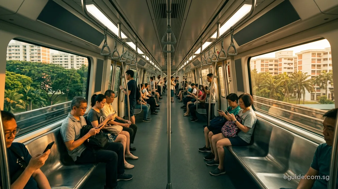
The route, end to end
Starting at Jurong East, where it shares a station with the East-West Line, the North-South Line heads north on a viaduct through Bukit Batok and Bukit Gombak to Choa Chu Kang, where the Bukit Panjang LRT begins. It continues to Yew Tee and Kranji before reaching Woodlands, the largest town in the north and an interchange with the Thomson-East Coast Line. From there it runs east along the north coast through Admiralty, Sembawang and Canberra, and then south through Yishun and Khatib.
Below Yio Chu Kang the line serves Ang Mo Kio town centre and then meets the Circle Line at Bishan. Shortly after Braddell and Toa Payoh it goes underground, passing Novena and Newton before running beneath Orchard Road at Orchard and Somerset. Dhoby Ghaut, City Hall and Raffles Place carry it through the civic district and the financial centre, and the last two stops, Marina Bay and Marina South Pier, sit on reclaimed land south of the bay.
Every station in order
The first table lists the stations in service from NS1 to NS28 in the order a train calls at them, with the other lines that share each station and the eGuide area page for the planning area where LTA records its exits. The second table lists the two stations LTA has announced for the line, with LTA's target year. There is no NS6 in service today: that code is kept for Sungei Kadut.
Stations in service, in order (27)
| Code | Station | Other lines here | eGuide area |
|---|---|---|---|
| NS1 | Jurong East | EW24JE5 2028 | Jurong East |
| NS2 | Bukit Batok | – | Bukit Batok |
| NS3 | Bukit Gombak | – | Bukit Batok |
| NS4 | Choa Chu Kang | BP1JS1 2028 | Choa Chu Kang |
| NS5 | Yew Tee | – | Choa Chu Kang |
| NS7 | Kranji | – | Sungei Kadut |
| NS8 | Marsiling | – | Woodlands |
| NS9 | Woodlands | TE2 | Woodlands |
| NS10 | Admiralty | – | Woodlands |
| NS11 | Sembawang | – | Sembawang |
| NS12 | Canberra | – | Sembawang |
| NS13 | Yishun | – | Yishun |
| NS14 | Khatib | – | Yishun |
| NS15 | Yio Chu Kang | – | Ang Mo Kio |
| NS16 | Ang Mo Kio | CR11 2030 | Ang Mo Kio |
| NS17 | Bishan | CC15 | Bishan |
| NS18 | Braddell | – | Toa Payoh |
| NS19 | Toa Payoh | – | Toa Payoh |
| NS20 | Novena | – | Novena |
| NS21 | Newton | DT11 | Newton |
| NS22 | Orchard | TE14 | Orchard, River Valley |
| NS23 | Somerset | – | Orchard |
| NS24 | Dhoby Ghaut | NE6CC1 | Museum |
| NS25 | City Hall | EW13 | Downtown Core |
| NS26 | Raffles Place | EW14 | Downtown Core |
| NS27 | Marina Bay | CC33TE20 | Downtown Core, Straits View |
| NS28 | Marina South Pier | – | Straits View |
Stations announced by LTA, with the target year (2)
| Code | Station | LTA target | Other lines here | eGuide area |
|---|---|---|---|---|
| NS3A | Brickland | 2034 | – | Bukit Batok |
| NS6 | Sungei Kadut | 2035 | DE2 2035 | Sungei Kadut |
Interchanges
Nine stations on the line connect with other rail lines:
- Jurong East (NS1) with the East-West Line, and from 2028 with the Jurong Region Line at JE5.
- Choa Chu Kang (NS4) with the Bukit Panjang LRT, and from 2028 with the Jurong Region Line at JS1.
- Woodlands (NS9) with the Thomson-East Coast Line.
- Bishan (NS17) with the Circle Line.
- Newton (NS21) with the Downtown Line.
- Orchard (NS22) with the Thomson-East Coast Line.
- Dhoby Ghaut (NS24) with the North East and Circle lines.
- City Hall (NS25) and Raffles Place (NS26) with the East-West Line.
- Marina Bay (NS27) with the Circle and Thomson-East Coast lines.
Ang Mo Kio (NS16) will add a Cross Island Line interchange at CR11, which LTA targets for 2030, and Sungei Kadut (NS6) will join the line to the Downtown Line extension in 2035.
How the line was built, stage by stage
The MRT story begins on this line. The first five stations opened in 1987, on the stretch between Yio Chu Kang and Toa Payoh, and the line reached the city before the end of that year. Dhoby Ghaut opened in December 1987, and it later became Singapore's first station shared by three lines.
The East-West Line began as part of the same system in 1987, and the two lines still meet at City Hall, Raffles Place and Jurong East. For its first years the north of the island had no rail link between Choa Chu Kang and Yishun. That gap was closed by the Woodlands Extension, which opened in 1996 and gave the line its present loop across the top of the island.
Later changes came in smaller steps. Jurong East gained extra platforms in 2012 to ease the transfer between the two oldest lines. In November 2014 the line was extended by about a kilometre from Marina Bay to Marina South Pier. Canberra, an in-fill station between Sembawang and Yishun, opened in 2019 with the code NS12.
Renewal of an older line
An older line needs its parts replaced. LTA's line page records the renewal of the North-South Line's six core systems and the arrival of new R151 trains, 106 in all, from the end of 2022. For planned changes to service hours on any weekend, SMRT's and LTA's notices are the place to look.
Stations still to come
Two stations will be added. Brickland (NS3A) sits between Bukit Gombak and Choa Chu Kang, in Bukit Batok; LTA announced in July 2023 that it is targeted for completion in 2034. Sungei Kadut (NS6), between Yew Tee and Kranji, is part of LTA's Downtown Line 2 extension and is targeted for 2035. It will become an interchange with the Downtown Line, which will run up from Bukit Panjang through a new station, DE1.
Which eGuide areas the line serves
Its stations have exits in the West Region (Jurong East, Bukit Batok and Choa Chu Kang), the North Region (Sungei Kadut, Woodlands, Sembawang and Yishun), the North-East Region (Ang Mo Kio) and the Central Region (Bishan, Toa Payoh, Novena, Newton, Orchard, River Valley, the Museum area, the Downtown Core and Straits View).
eGuide area pages on this route: Jurong East, Bukit Batok, Choa Chu Kang, Sungei Kadut, Woodlands, Sembawang, Yishun, Ang Mo Kio, Bishan, Toa Payoh, Novena, Newton, Orchard, River Valley, Museum, Downtown Core, Straits View.
| Planning area | URA region | Stations open | Stations announced | Residents (June 2026) | eGuide page |
|---|---|---|---|---|---|
| Jurong East | West | 1 | 0 | 72,160 | Area profile |
| Bukit Batok | West | 2 | 1 | 165,680 | Area profile |
| Choa Chu Kang | West | 2 | 0 | 185,520 | Area profile |
| Sungei Kadut | North | 1 | 1 | 700 | Area page |
| Woodlands | North | 3 | 0 | 255,280 | Full guide |
| Sembawang | North | 2 | 0 | 115,270 | Area profile |
| Yishun | North | 2 | 0 | 231,030 | Full guide |
| Ang Mo Kio | North-East | 2 | 0 | 159,330 | Full guide |
| Bishan | Central | 1 | 0 | 87,810 | Area profile |
| Toa Payoh | Central | 2 | 0 | 148,940 | Area profile |
| Novena | Central | 1 | 0 | 53,930 | Area profile |
| Newton | Central | 1 | 0 | 10,390 | Area profile |
| Orchard | Central | 2 | 0 | 1,550 | Area profile |
| River Valley | Central | 1 | 0 | 13,350 | Area profile |
| Museum | Central | 1 | 0 | 860 | Area page |
| Downtown Core | Central | 3 | 0 | 6,230 | Full guide |
| Straits View | Central | 2 | 0 | none recorded | Area page |
A station on a boundary counts in each area it touches. Residents: SingStat, June 2026; the 17 areas together had 1,508,030 residents.
For four of our full guides it is the backbone of daily travel. Woodlands and Yishun residents ride it into the city, Ang Mo Kio has two of its stations, and the Downtown Core has three of its stations.
Frequently asked questions
Where does the North-South Line start and end?
It runs from Jurong East (NS1) in the west to Marina South Pier (NS28) in the south, by way of the north of the island.
Why is there no NS6 or NS3A station?
Those codes are reserved for stations LTA has planned: Sungei Kadut (NS6), targeted for 2035, and Brickland (NS3A), targeted for 2034.
Which operator runs the line?
SMRT runs the North-South Line, as it does the East-West, Circle and Thomson-East Coast lines and the Bukit Panjang LRT.
Which was the last station added?
Canberra (NS12), between Sembawang and Yishun, opened in 2019.
Sources
- Land Transport Authority, North-South Line page: length, station count, opening history, the renewal of core systems and the R151 trains.
- Land Transport Authority, length of the rail network (end-2024) with the opening dates of each extension.
- Land Transport Authority, rail system map (station codes) and the news release of 28 July 2023 on Brickland station.
- Land Transport Authority, Downtown Line 2 extension page (Sungei Kadut and DE1, 2035).
- Land Transport Authority, MRT station exits (data.gov.sg, 18 October 2026), placed on URA Master Plan 2025 planning areas.